Chile is longer than you think: Santiago, the Atacama, and Torres del Paine at the end of the world
Chile is the longest and thinnest country in the world.
4,300km from north to south, never more than 180km wide. The Atacama Desert in the north is the driest place on earth. Torres del Paine at the southern end is inside the Patagonian wind system. Between them: the wine valleys, the Lake District, the Chilean Fjords, the Easter Island option if you’re going that way.
I did north and south and the capital in the middle. The middle parts I’ll do on the next trip.
Santiago: better than advertised
Santiago has a reputation as a transit city for people going south and north. This is underselling it.
The city sits in a valley between the Andes (visible on clear days from most of the city, a wall of snow-capped mountains rising to 5,000+ metres east of the urban area) and the coastal range to the west. The Mapocho River runs through the centre. The neighbourhoods are distinct and genuinely worth the time.
Barrio Italia and Barrio Lastarria. The two neighbourhoods I spent most of my time in. Barrio Italia for the antique and vintage shops, the design studios, the coffee roasters (El Vergel, Santiago’s best specialty coffee scene). Barrio Lastarria for the bookshops, the cultural centre in the old neoclassical building, the square with the restaurants.
Cerro Santa Lucía and Cerro San Cristóbal. Two hills in the city with different characters. Santa Lucía is a formal garden park in the middle of the city (15 minutes uphill from the Plaza de Armas, the views over the historic centre). San Cristóbal is a full nature park (the funicular goes up to the Madonna statue at the summit, the views over the whole city and the Andes on a clear winter morning).
La Vega and Mercado Central. La Vega is the wholesale fruit and vegetable market north of the Mapocho: where restaurants buy their produce, where you eat lunch in the small comedores (eating stalls) for a fraction of what you’d pay at a restaurant. The Mercado Central for the fish: a beautiful iron-framed building with fish stalls and seafood restaurants inside. The ceviche and the congrio (conger eel, the classic Chilean seafood).
Chilean food: Not as internationally famous as Peruvian or Mexican, but genuinely good on its own terms. Cazuela (meat and vegetable stew). Empanadas (the Chilean version: baked, filled with beef, egg, olive, and onion). Chorrillana (chips topped with sautéed onions and sliced beef and fried eggs, a late-night bar food that sounds better at midnight than it does written down and is very good either way). Carménère wine.
The Atacama Desert: the night sky situation
San Pedro de Atacama is a small town at 2,400 metres in the Atacama, the driest desert on earth. I went for four days and the nights are the reason.
The Atacama has minimal light pollution, clear skies almost every night of the year, and high altitude that reduces atmospheric interference. The result is the most extraordinary stargazing available from Earth’s surface outside of a few very specific locations.
The Milky Way is not a faint band: it’s a river of light dense enough to make the sky feel dimensional.
The Magellanic Clouds (two dwarf galaxies visible from the southern hemisphere) are visible to the naked eye. I saw five shooting stars in one hour of looking up.
Moon Valley (Valle de la Luna). Salt formations and wind-eroded rock in a landscape that earned its name. At sunset the formations turn from white to orange to red in sequence. The surrounding mountains go pink. Worth the tourist crowds for the timing.
The salt flat (Salar de Atacama). Chile’s largest salt flat: flamingos in the saline lagoons at the edges (three flamingo species in the Atacama, including the Andean flamingo). The mirrors of the lake reflecting the mountains above.
The geysers (El Tatio). 90 minutes from San Pedro, at 4,300 metres, the highest geyser field in the world. Go at 6am when the steam is most dramatic (cold air, hot water, the columns at maximum height at dawn). The drive up the mountain road in the pre-dawn dark with the stars still visible. Worth the alarm clock.
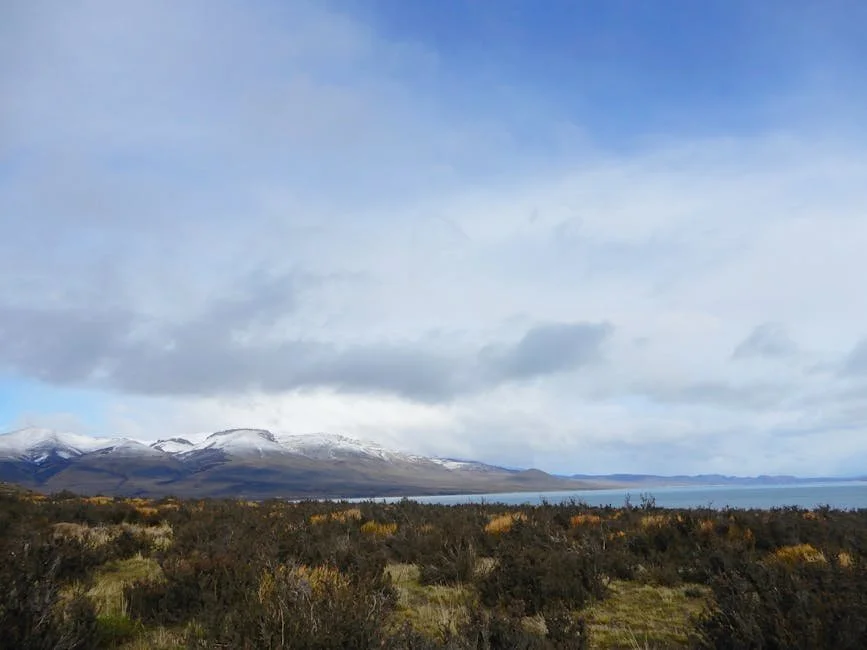
Torres del Paine: the end of the world
Torres del Paine National Park in Chilean Patagonia is the most visited national park in South America for reasons that are entirely justified.
The Torres (towers): three granite spires rising vertically from the surrounding plain, exposed by glacial action, the most distinctive mountain formation in South America. The hike to the Mirador Las Torres viewpoint (18km return, 7-8 hours): the final 45 minutes scramble over moraine to a glacial lake directly below the towers.
This is the objective.
The W Trek. The standard multi-day route connecting the main sights of the park: the French Valley with its hanging glaciers and condors, the Grey Glacier and its floating icebergs, the towers themselves. Takes 4-5 days. Book refugio (mountain hut) accommodation many months ahead; it sells out.
The weather. Patagonian weather in Torres del Paine is notorious. Four seasons in one day. Horizontal rain and 80km/h wind one moment, clear and windless the next. Pack for everything. The wind is the primary challenge; dress in layers and wind protection. The reward for a clear-sky morning with the towers is complete.
The wildlife. Guanacos (wild relatives of the llama) everywhere in the park, completely unafraid of people. Condors over the French Valley. Pumas (the park has a healthy population; dawn and dusk are the times). Grey foxes that will approach your camp.
Practical things
The length of Chile. Flying within Chile is often necessary unless you have weeks. Santiago to San Pedro: 2-hour flight or 24-hour bus. Santiago to Puerto Natales (Torres del Paine gateway): 4-hour flight.
Altitude in the Atacama. San Pedro is at 2,400m; El Tatio at 4,300m. Take the acclimatisation seriously: arrive, rest, eat lightly, don’t attempt El Tatio on your first day.
Booking Torres del Paine in advance. The park limits visitor numbers and refugio beds and campsites for the W Trek sell out 6+ months ahead in peak season (November-March). Book everything before you arrive in Chile.
Coverage in Santiago and the main cities is good. San Pedro de Atacama has coverage in the town but signal drops in the desert. Torres del Paine has coverage near the visitor centre and administration area but limited in the backcountry. I’ve put together an eSIM guide for Chile with current options.
Chile goes from one extreme to another.
The driest desert on earth. The most dramatic mountain park on the continent. A capital city that was better than I expected.
Go from top to bottom if you have the time.
More from the region
Heading to Chile? Sort your eSIM first.
I've compared the main providers, checked the real pricing, and put together a guide on the best eSIM options for Chile.
Best eSIM for Chile →